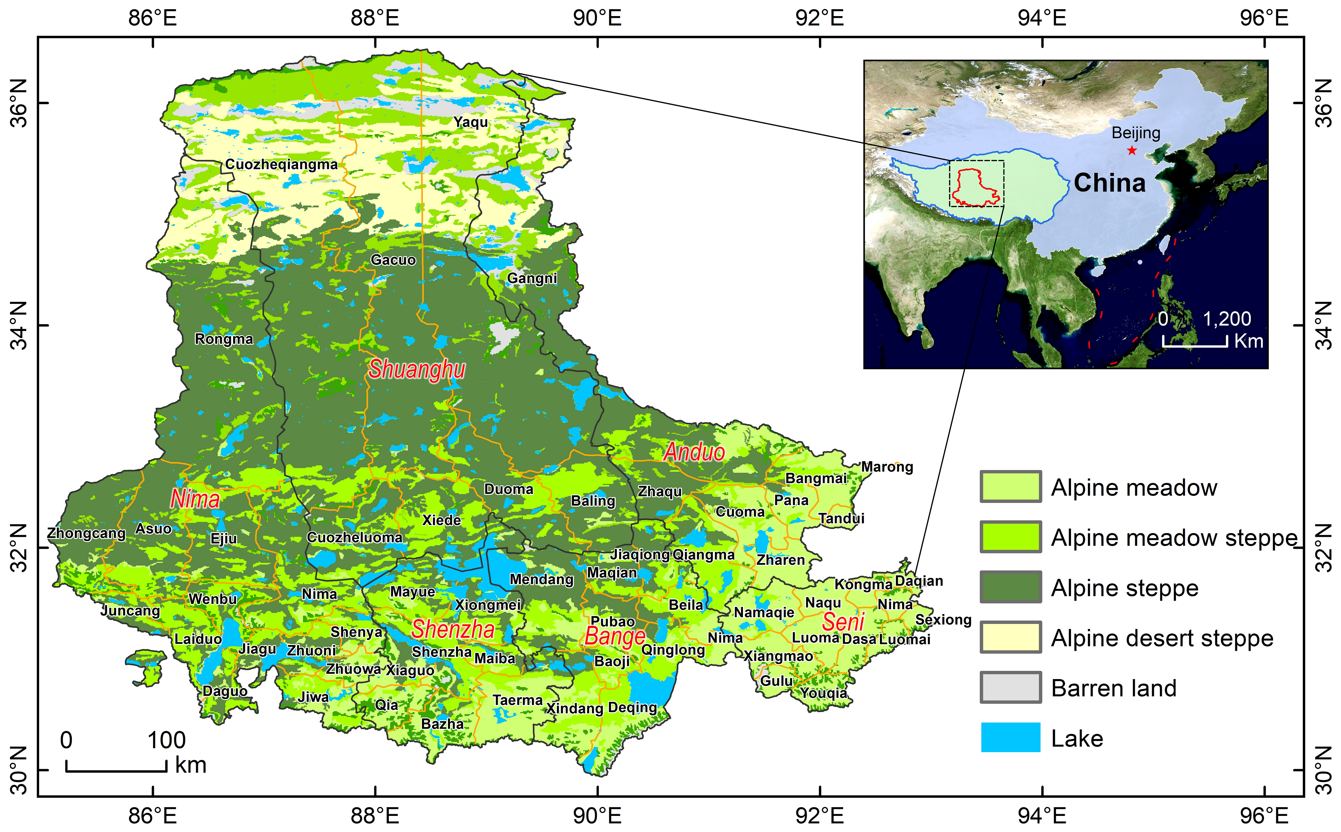
: The problem of grassland degradation resulting from livestock production at the expense of local grasses has become a serious environmental problem worldwide. To maintain livestock production and sustainable grassland development, a better grasp of the extent and intensity of grassland utilization needs to be realized. We developed a model to monitor the intensity of grazing in a typical grazing area (Selinco basin) of the Qinghai-Tibet Plateau. Based on combining the number of livestock at the township scale with their matching livestock habitat area and location, the biomass consumed by livestock was then assigned to the productivity supply map (NPP) by a mathematical iterative algorithm from the perspective of different foraging habits of different livestock. The objective is to more accurately measure the overall grazing pressure on the pasture as well as to estimate livestock pasture utilization. The model has confirmed that there are obvious spatial differences in the intensity of grassland utilization in the Selinco basin, which is significantly lower except in the southwestern region. Overall grazing area derived from the statistics on the pixel is 150, thousands km 2. Among them, the area of moderate grazing area is 130, thousands km 2, accounting for 87% of the total grazing area, and the area of overgrazing area is 20, thousands km 2, accounting for 13% of the total grazing area. Our model can quantify human activities spatially and provide a reliable and accurate scientific basis for livestock production development and ecological environment management.