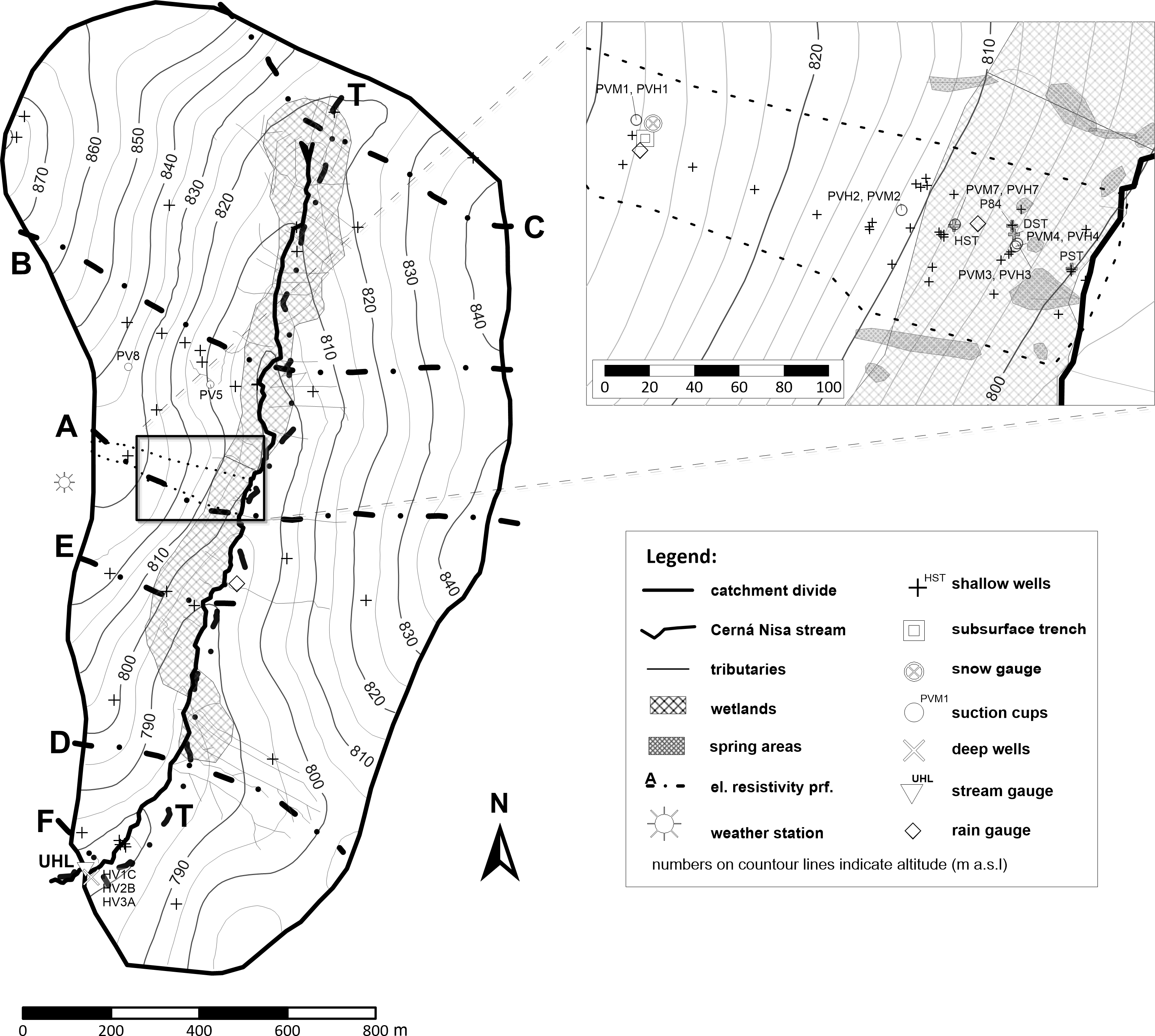
Modelling results in the small (1.78 km2) experimental catchment Uhlířská located in the northern part of the Czech Republic at the average elevation of 822 m a.s.l. are presented. While the basic hydrological and meteorological monitoring has started already in 1982, investigation of the subsurface flow adjoined in 1995. A detailed survey of water and isotope (18O, 2H, 3H, 3H/3He) fluxes across the catchment storage compartments has been in operation since 2006. The combined vadose/saturated zones modeling with support of partial extrapolation of 18O content in precipitation yielded the following mean balance for the period 1961-2014: 456 out of 1220 mm annual precipitation depth are percolating through the soil matrix domain and 534 mm through the preferential domain in the hillslope soil profile. The saturated zone is recharged annually by 416 mm, consisting of the entire matrix flow and 12,5 % of the preferential flow from the permeable hillslopes covered by Cambisols and Podzols, as well as by the contribution of 22 mm from the less permeable riparian wetland Histosols. The aquifer geometry was determined by means of electrical resistivity tomography (ERT) including inverse modelling (RES2DINV). Water and isotope fluxes were computed using a sequence of models. They include S1D software for the vadose zone modeling including 18O transport and Modflow, Modpath and MT3DS determining residence time and flow trajectories in the saturated zone. Isotopes 3H and 3H/3He improved the model confidence. The water residence time on the hillslopes does not exceed 1 year, while the saturated zone indicates about 10 years, with a 20% portion of water older than 100 years in the deepest part of the aquifer. The combination of numerical modelling approaches with computation of water balance and isotope-supported calibration is considered innovative, particularly the 3H/3He method to determine water residence times of young groundwater in the saturated zone.