Jiahui Xu

and 7 more

Water level and storage are the most critical components for understanding water cycle changes and mechanisms better. Given the lack of in-situ river level monitoring and consecutive satellite altimetry data in the Yarlung Zangbo River (YZR) in High Mountain Asia (HMA) caused by the harsh environment and complex terrain, obtaining accurate and long-term water characteristic changes is challenging. In this study, we reconstructed the dense time series of the YZR water characteristic changes from 2000 to 2020. The general idea of this method is to obtain the water area information derived from the Global Land Analysis and Discovery (GLAD) dataset, using the hypsometric curves to fill Hydroweb lacked river water level records from the available river area data, and to reconstruct the virtual stations (VSs) water levels in the YZR. Moreover, by combining area estimates with the changes in water level, the variations of the YZR water storage have been obtained. The obtained YZR water storage variation result was compared with the terrestrial water storage anomaly (TWSA) of Brahmaputra basin from Gravity Recovery and Climate Experiment (GRACE) data to discuss the response relationship. Results indicated that the reconstructed water area applied in the YZR with high quantity accuracy (approximately 82%) and the reconstructed water levels agreed reasonably well with Hydroweb water levels with an average R of 0.89. Furthermore, the densified reconstructed water levels provided critical and accurate information on the long-term monitoring in HMA. The YZR water area, level and storage have apparent significant seasonal fluctuations. The declining amplitude of water levels of VSs expanded from the upstream region to the downstream region. In addition, the change in river water storage only accounts for approximately one tenth of that in the basin. This study sheds new light on bridging the gap in monitoring the long-term water characteristic changes over poorly gauged basins by means of optical imaging in combination with partial altimetry satellite, and can be effectively applied in other large rivers in HMA.

Pengfei Zhan

and 6 more

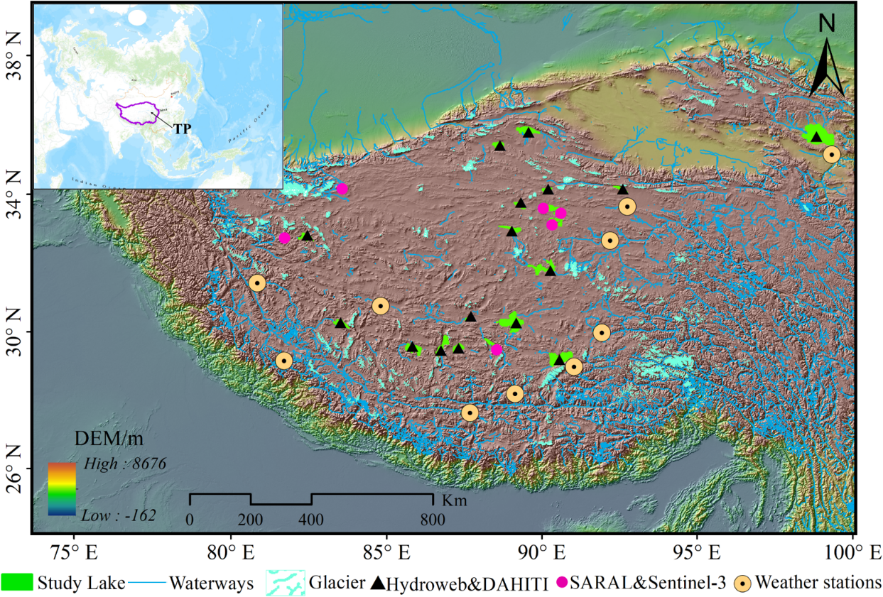
The inland lakes in the Tibetan Plateau (TP), with closed catchments and minimal human disturbance, are important indicators to climate change. However, examination of the spatiotemporal patterns of the Tibetan lake changes, especially for water level variation, was usually limited by inadequate measurement accessibility. This obstacle has been remedied by the developing satellite altimetry observations. The more recent studies revealed the growth tendency of lakes in the central TP had been decelerated or reversed during the period 2010-2016. It has not been systematically investigated whether the deceleration or hiatus would last in the following years thus far. This study aims to combine the traditional and recently-advanced altimetry observations to update our understanding of Tibetan lake changes in recent years. The results reveal that water level changes of the 22 examined lakes showed abrupt rises during the period 2016-2018, but the onsets and magnitudes of the rises varied among the lakes. During the study period, the water level of the nine lakes in the northern TP displayed a drastic rising trend with an average rate of 0.82 m/a. In the central TP, the lake level changes were generally divided into two categories. The water levels for the lakes in the western CTP rose rapidly, while in the eastern CTP, the lake water levels rose slowly with an average rising rate less than 0.40 m/a. The water levels for lakes in the northeastern TP and northwestern TP kept a stably rising tendency. According to the results of climate analysis, the spatial differences of the lake level rise rates were primarily caused by the spatial and temporal changes of precipitation over the TP, which may be related to the large-scale atmospheric circulation affected by the El Niño and La Niña events.