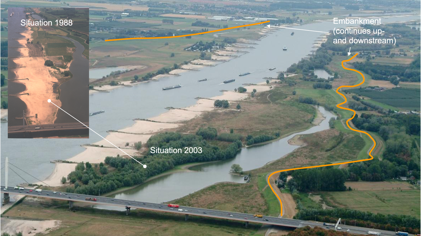
Gertjan Geerling1,3, Ellis Penning1, Christine Rogers1, Cindy van de Vries - Safavi Nic1, Valesca Harezlak1, Stanford Wilson2, Gennadii Donchyts11Deltares, Delft, The Netherlands2Rijkswaterstaat-WVL, Lelystad, the Netherlands3Deptartment of Environmental Science, Radboud University, Nijmegen, the NetherlandsCorresponding author: Gertjan Geerling email: [email protected] research was funded by the research programme of the Dutch National Water Authority (KPP-Corporate Innovation Programme and the KPP- Innovative Monitoring). We thank the valuable discussions with the Floodplain Management Team of the National Water Authority (RWS-ON) and all other contributing stakeholders.AbstractIn deltas, rivers are often embanked and have a limited discharge capacity. In case these rivers also have a fixed riverbed for navigation, vegetation succession in the floodplains will reach climax stages. This leads to increasing hydraulic roughness that lowers the discharge capacity and prompts the river manager to intervene in the floodplain vegetation. The Dutch river manager depended on a 6-year map cycle of manually digitized aerial photographs for assessment of the state of hydraulic resistance. As the amount of agriculture in floodplains is receding in favor of nature rehabilitation projects, the vegetation dynamics increase. At the same time, the bigger floods were anticipated in the future. Therefore, more up-to-date floodplain vegetation maps with a short processing time were needed for about 500 kms of river in the Netherlands. We present an operational web-based monitoring tool that analyses sentinel-2 data on the fly though Google Earth Engine to provide an overview of the current state of the vegetation in the entire floodplain area of the Dutch river systems Rhine and Meuse. It is the first satellite-based application in an operational setting for the Dutch National River Manager (Rijkswaterstaat). The tool compares a map of allowable vegetation with the remotely sensed current situation for a quick scan of hotspots and can create reports on the cadastral (landowner) level. We describe the results of the image classifications and the role of this tool in the full process of the Dutch flood risk management process.Keywords: river management, vegetation, vegetation succession, remote sensing, open data, google earth engine