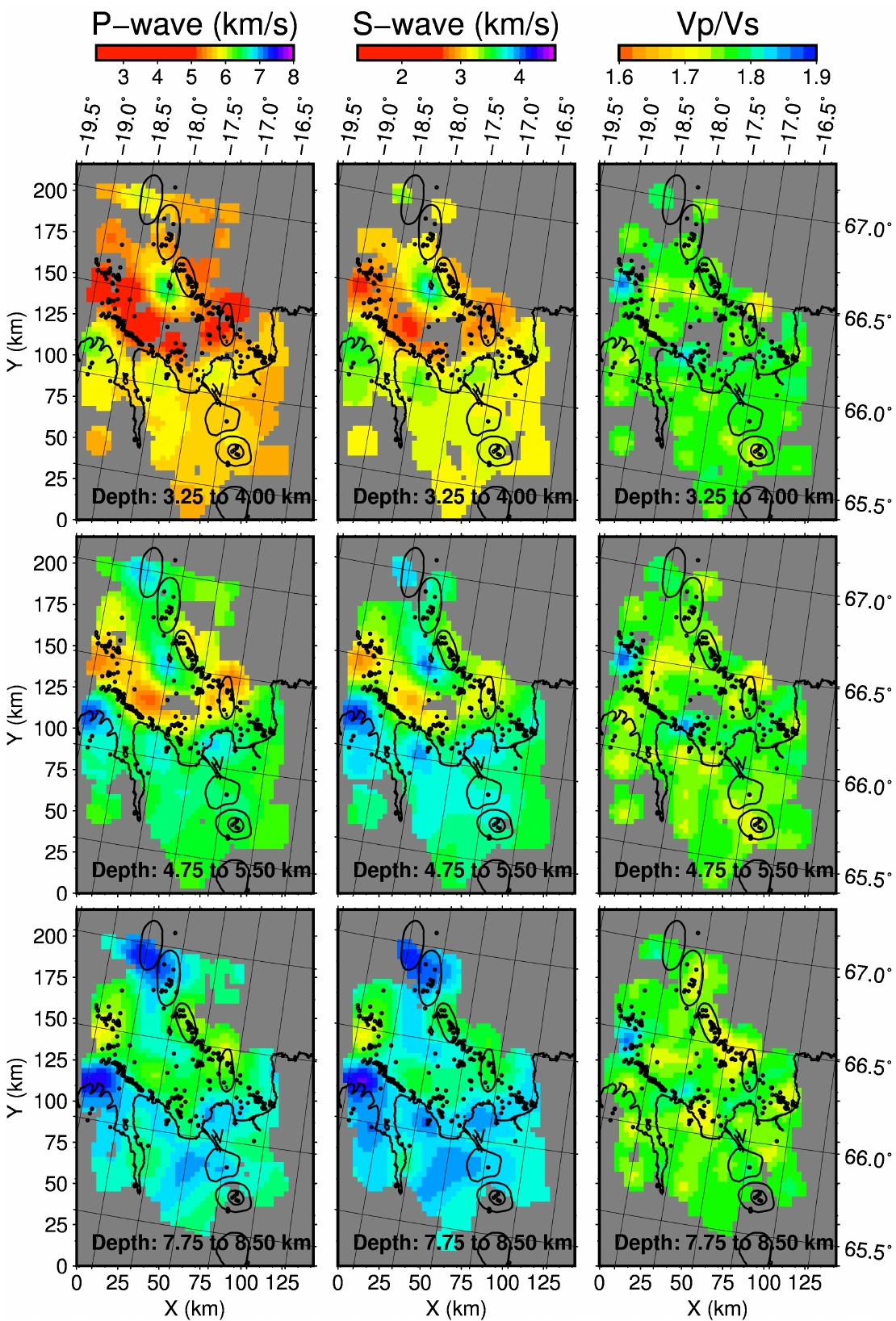
Local earthquake tomography has been carried out in the Tjornes Fracture Zone. This transform region connects the Mid-Atlantic Ridge with the Northern Volcanic Zone in Iceland in a mostly offshore area. The challenge to record seismic information in this area was the motivation for the North ICeland Experiment (NICE). Fourteen ocean-bottom seismometers and eleven on-land stations were installed in the project and operated simultaneously with the permanent Icelandic seismic network (SIL) during summer 2004. Data from the experiment were used to estimate P- and S-wave crustal velocities. Also, the Bouguer gravity anomaly was derived for comparison with the tomographic results. Upper-crustal velocities are found to be relatively low in the offshore region. In particular, low velocities are mapped along the Husavik-Flatey Fault, where a more confined negative gravity anomaly and a sedimentary basin are found. Low velocities are also mapped along the Grimsey Oblique Rift and in a zone connecting these two main lineaments north of Skjalfandi Bay. The northern half of the aseismic Grimsey Shoal appears as a fast anomaly. Furthermore, localized high-velocity anomalies are found beneath northern Trolaskagi and Flateyjarskagi Peninsulas, where bedrock dates from Upper and Middle Miocene (10-15 Ma). Regions of low Vp/Vs ratio are mapped at depth along the main lineaments. Low velocities along the lineaments are interpreted as due to fracturing extending into the middle crust, while fast upper-crustal velocities beneath Tertiary formations are associated with relic volcanoes. Low Vp/Vs ratios along the lineaments are interpreted as due to the presence of supercritical fluids.