Julia Knapp

and 1 more

Short-term surges in stream temperature in response to storm events have frequently been observed in urban areas , highlighting the need for improved understanding of the factors influencing urban stream temperature. Urban land cover complexity and infrastructure designed for rapid water routing to the sewer system create a direct link between storm events and water release processes, influencing urban stream temperature responses. This study aims to identify predictors of diverse stream temperature response patterns to summer storms. We analyzed 403 storm events from six urban and semi-urban catchments along the US East Coast using dynamic time warping to identify archetype patterns of stream temperature responses. We further disentangled observed stream temperature increase patterns to reveal the drivers associated with “heat pulses”, which are characterized by a rapid but high-magnitude temperature increase followed by a sharp temperature drop at the start of the hydrograph. Our results show that stream temperature patterns were event-specific and linked to pre-event conditions and rainfall-runoff characteristics, with the shape of the hydrograph and rainfall-runoff response identified as the most important determinators of the observed temperature response patterns. Ponded surface waters and storm drains, as well as cooler water from the shallow subsurface, were identified as likely sources contributing to temperature patterns. These findings have important implications for understanding urban hydrology and the contributions of different source zones in urban catchments. Specifically, our results suggest that streamwater temperature can serve as a cost-effective tracer of information about urban water sources and pathways, aiding in the understanding of complex urban hydrology.

Jeffrey Wade

and 3 more

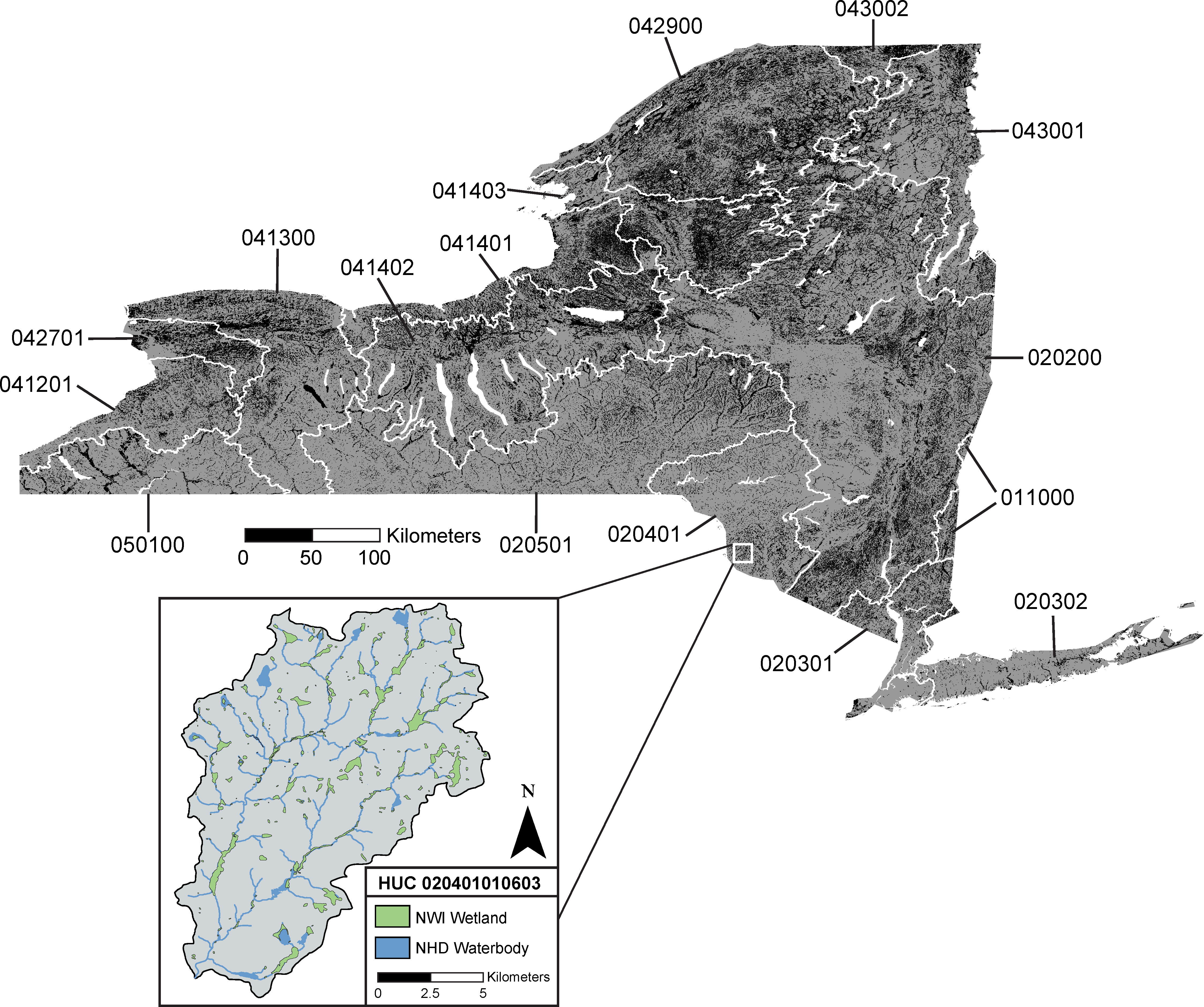
Recent revisions to the definition of the “waters of the United States” (WOTUS) have considerably altered how wetlands are federally regulated under the Clean Water Act. The two most recent modifications to WOTUS, the Clean Water Rule (CWR) and the Navigable Waters Protection Rule (NWPR), represent two opposing approaches to the federal wetland policy. Despite their implementation, the impacts of these rules on the regulation of wetlands have as of yet been poorly characterized at broad spatial scales. Using New York State (NYS) as a case study, we evaluated the jurisdictional statuses of more than 373,000 wetlands under the CWR and the NWPR to assess the landscape-scale effects of WOTUS re-definitions. We found that statewide and within each of NYS’s hydrologic regions, the NWPR protects fewer wetlands and less total wetland area than the CWR. The efficacy of the two regulations varied considerably in space across NYS, highlighting the need for comprehensive, nationwide assessments of wetland policy outcomes. We also observed that both rules produced non-uniform patterns in jurisdiction across a range of landscape positions and wetland sizes, preferentially protecting large wetlands close to the stream network. This effect was particularly pronounced under the NWPR, which excludes all geographically isolated wetlands from protection. Our findings in NYS emphasize the existence of unique patterns in protected wetlands across spatial scales, highlighting the value in applying geospatial analyses to evaluate environmental policy.