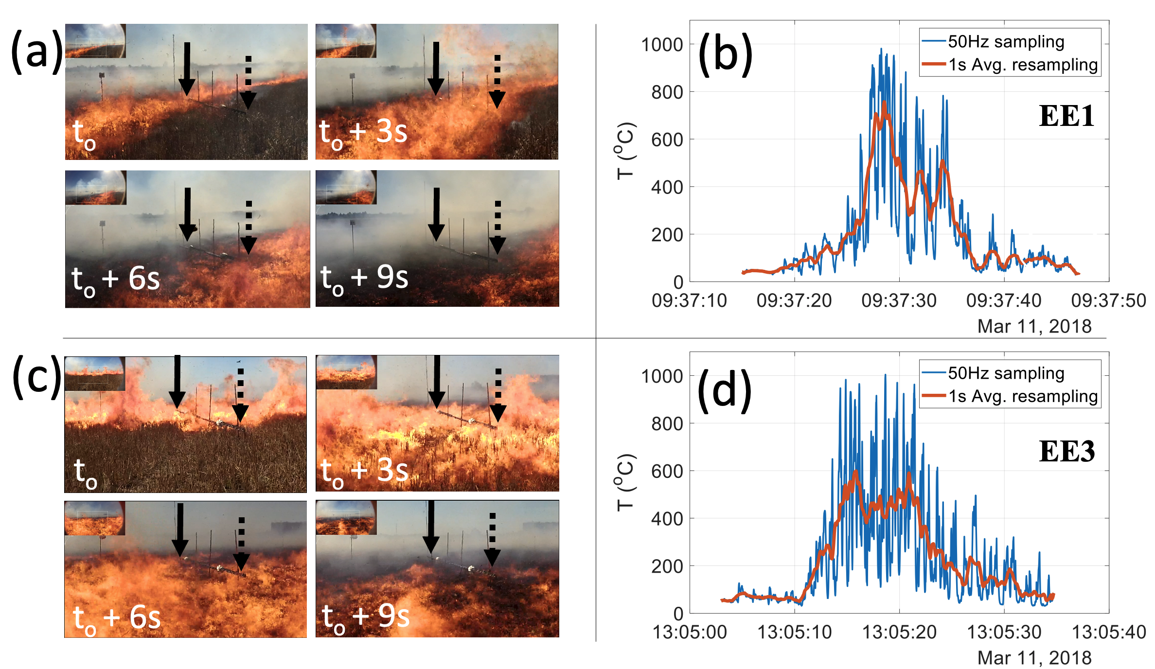
We present novel in-field vegetation fire observations, and the analyses used to process the data, using brightness temperatures recorded by longwave infrared camera and thermal image velocimetry. The brightness temperatures from a wind-driven stubble wheat fire were obtained in video format with a 60 frames per second (fps) acquisition rate. Multi-level sonic anemometers mounted on a 10m in-fire tower were used for in-situ measurements of turbulent velocity and air temperatures, while fuel level air and flame temperatures were collected by an array of thermocouples. The camera’s image pixel resolution was adequate to resolve dynamics and in accordance with the in-fire thermocouple spacing distances. The in-situ and remotely measured flaming zone dynamics were derived using two different methodologies, Thermal Image Velocimetry (TIV) and Image Segmentation (IS). The results highlight spatial and spectral information of coherent turbulent and mean velocity structures. The power spectra decomposition of the thermal image velocimetry showed similar spectral characteristics to the sonic velocity measurements during the fire passage under the tower with a similar inertial subrange slope. This result reveals plausible evidence of interaction between the flaming zone and wind turbulence for a prescribed rapidly moving stubble wheat fire. This research presents a new field measurement methodology for understanding fire-atmospheric interactions between the flaming zone and the immediate overlying atmospheric turbulent boundary layer.