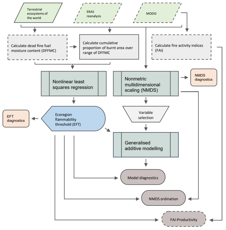
Anthropogenic climate change is creating a more flammable future by increasing the number of days when vegetation is dry enough to burn. Indices representing the percent moisture content of dead fine fuels as derived from meteorological data have been used to assess geographic patterns and temporal trends in vegetation flammability. To date, this approach has assumed a single flammability threshold, typically between 8 and 12%, controlling fire potential regardless of the vegetation type or climate domain. Here we investigate geographic variation in fuel moisture levels associated with observed fire activity among ecoregions by analysing global reanalysis data and remotely sensed burnt area products. This geospatial analysis identified a wide range of ecoregion flammability thresholds (EFTs) associated with fire activity, often well above or below the commonly used range of values. Many boreal and temperate forests, for example, can burn with much higher fuel moisture than previously identified; Mediterranean forests, on the other hand, tend to burn with consistently low fuel moisture. Bayesian modelling showed that EFTs are primarily driven by eco-climatological variables, particularly precipitation and temperature. Our analysis also identified complex associations between vegetation structure, fuel types, and climatic conditions highlighting the complexity in vegetation-climate-fire relationships globally. Our study provides a critical, necessary step in understanding and describing global pyrogeography and tracking changes in spatiotemporal fire activity.