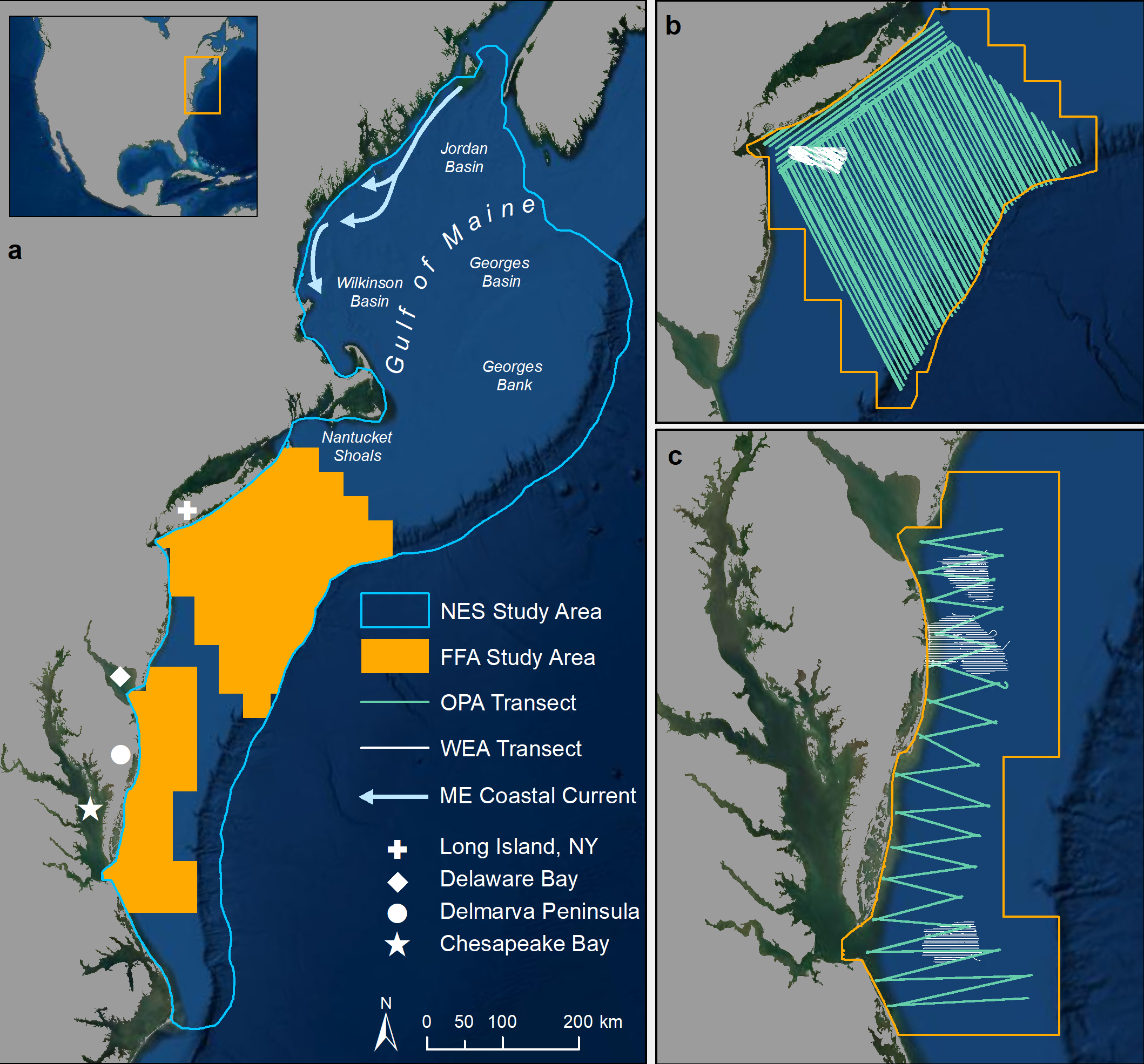
Forage fishes are a critical food web link in marine ecosystems, aggregating in a hierarchical patch structure over multiple spatial and temporal scales. Surface-level forage fish aggregations (FFAs) represent a concentrated source of available prey for surface- and shallow-foraging marine predators. Existing survey and analysis methods are often imperfect for studying forage fishes at scales appropriate to foraging predators, making it difficult to quantify predator-prey interactions. In many cases, general distributions of forage fish species are known; however, these may not represent surface-level prey availability to predators. Likewise, we lack an understanding of the oceanographic drivers of spatial patterns of prey aggregation and availability or forage fish community patterns, generally. Specifically, we applied Bayesian joint species distribution models to bottom trawl survey data to assess species- and community-level forage fish distribution patterns across the US Northeast Continental Shelf (NES) ecosystem. Aerial digital surveys gathered data on surface FFAs at two project sites within the NES, which we used in a spatially explicit hierarchical Bayesian model to estimate the abundance and size of surface FFAs. We used these models to examine the oceanographic drivers of forage fish distributions and aggregations. Our results suggest that, in the NES, regions of high community species richness are spatially consistent with regions of high surface FFA abundance. Bathymetric depth drove both patterns, while subsurface features, such as mixed layer depth, primarily influenced aggregation behavior and surface features, such as sea surface temperature, sub-mesoscale eddies, and fronts influenced forage fish diversity. In combination, these models help quantify the availability of forage fishes to marine predators and represent a novel application of spatial models to aerial digital survey data.