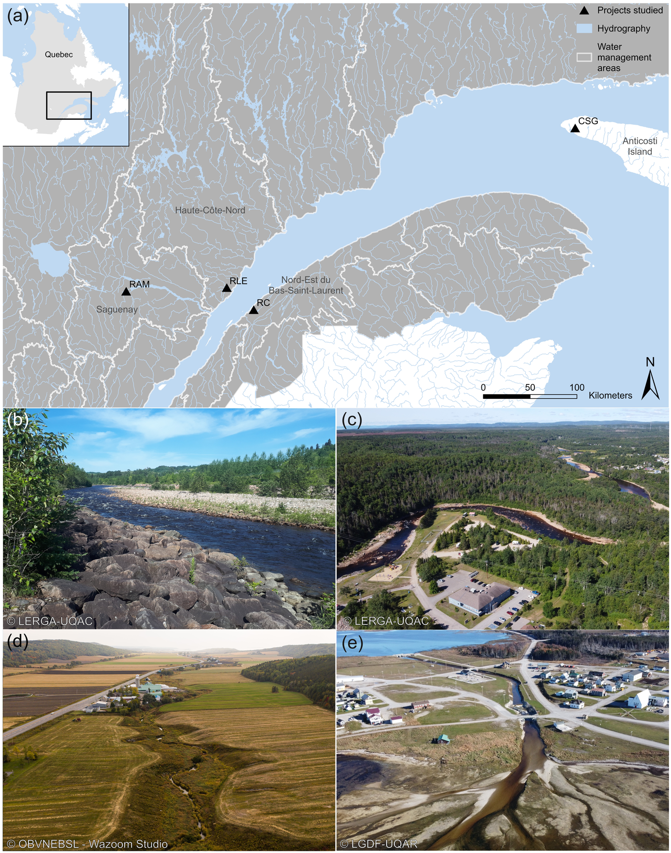
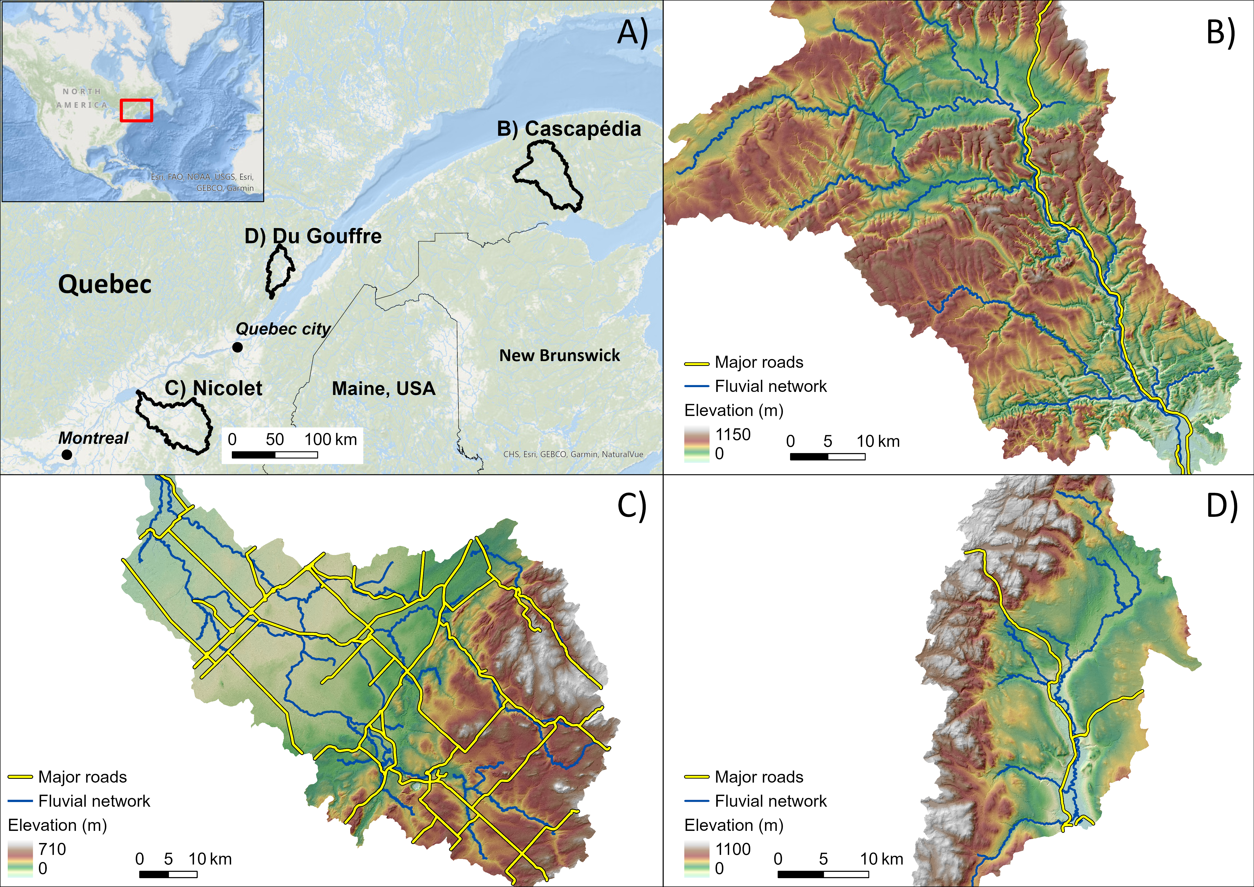
Fluvial hazards of river mobility and flooding are often problematic for road infrastructure and need to be considered in the planning process. The extent of river and road infrastructure networks and their tendency to be close to each other creates a need to be able to identify the most dangerous areas quickly and cost-effectively. In this study we propose a novel methodology using random forest (RF) machine learning methods to provide easily interpretable fine-scale fluvial hazard predictions for large river systems. The tools developed provide predictions for three models: presence of flooding (PFM), presence of mobility (PMM) and type of erosion model (TEM, lateral migration, or incision) at reference points every 100 meters along the fluvial network of three watersheds within the province of Quebec, Canada. The RF models uses variables focused on river conditions and hydrogeomorphological processes such as confinement, sinuosity, and upstream slope. Training/validation data included field observations, results from hydraulic and erosion models, government infrastructure databases, and hydro- geomorphological assessments using 1-m DEM and satellite/historical imagery. A total of 1,807 reference points were classified for flooding, 1,542 for mobility, and 847 for the type of erosion out of the 11,452 reference points for the 1,145 km of rivers included in the study. These were divided into training (75%) and validation (25%) datasets, with the training dataset used to train supervised RF models. The validation dataset indicated the models were capable of accurately predicting the potential for fluvial hazards to occur, with precision results for the three models ranging from 83% to 94% of points accurately predicted. The results of this study suggest that RF models are a cost-effective tool to quickly evaluate the potential for fluvial hazards to occur at the watershed scale.