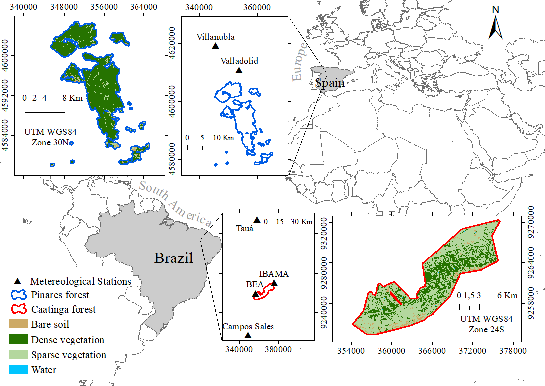
Evapotranspiration (ET) plays an important role in integrated water resource planning, development and management. This process is particularly relevant in semiarid regions. The aim of the present study is to compare the actual spatial and temporal evapotranspiration (ETa) patterns and temporal trends in two semiarid forests, one in Brazil (Aiuaba) and the other in Spain (Valladolid). We used the Surface Energy Balance Algorithm for Land (SEBAL) to assess the effect of climatic variation in both areas. In the Brazilian semiarid forest, Caatinga is the main vegetation, while it is stone pine in Spain. For this purpose, 69 Landsat-5 and 42 Landsat-8 images (1995 – 2019) were used. The Mann-Kendall test was applied to assess the occurrence of trends in precipitation, temperature and potential evapotranspiration data; and the Temporal Stability Index (TSI) to know which areas have greater seasonal ETa. The annual amplitude of the potential evapotranspiration (ET0) is the same in both areas, however, the Caatinga values are higher. In the Caatinga forest, when ET0 presents its highest values throughout the year, ETa presents the lowest, and vice versa. In the Pinares forest, ETa follows the ET0 dynamics during the year, and the difference between ET0 and ETa is maximum during the summer. The Caatinga forest showed a greater spatial variation of ETa than the Pinares forest as well as a greater extension with lower temporal stability of ETa than the Pinares forest. Both the Caatinga forest and the Pinares forest showed significant annual trends of increase for ET0 and ETa: 3.5 mm and 2.2 mm, and 7.0 mm and 3.9 mm, respectively.