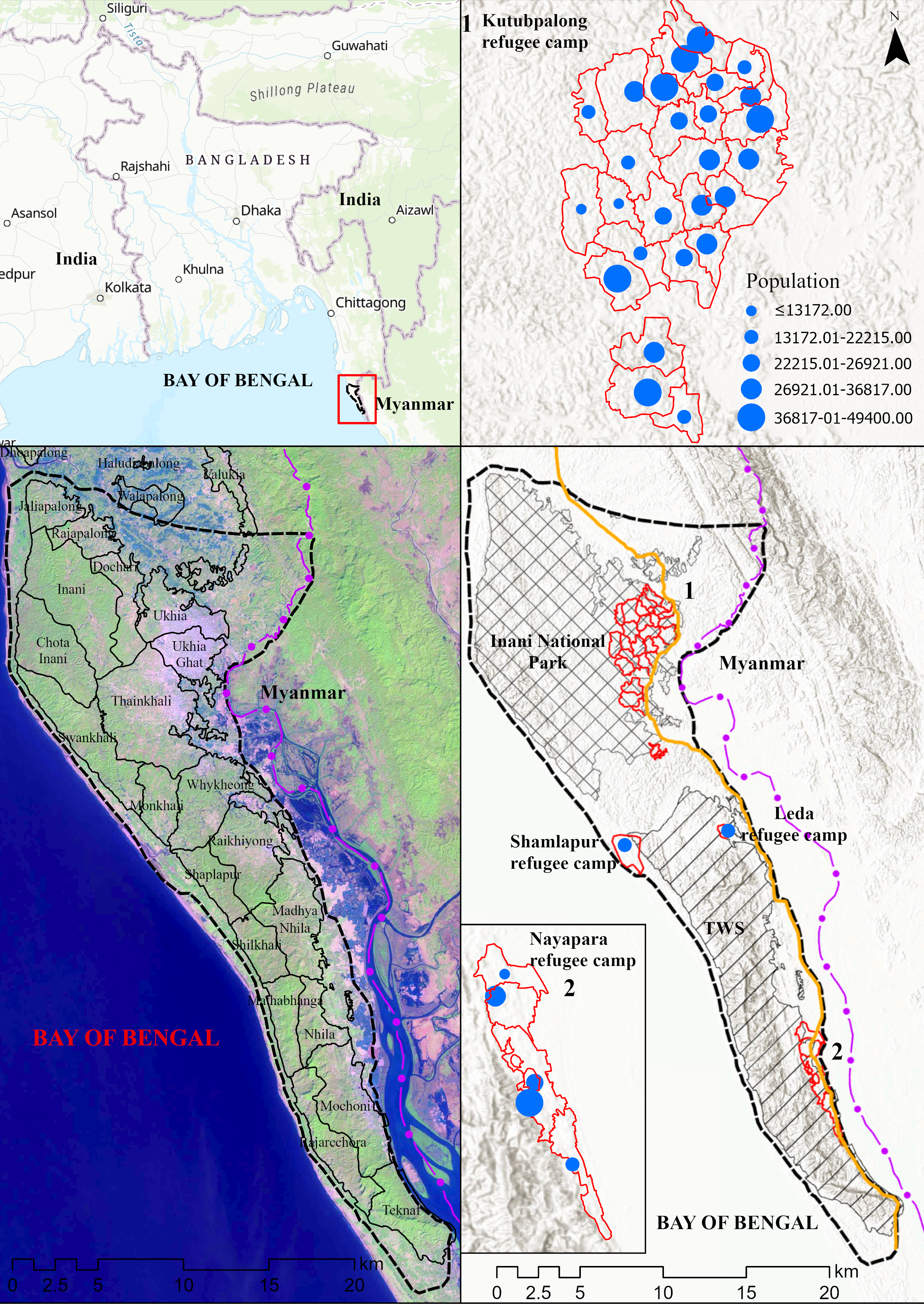
Violence in Rakhine, Myanmar forcibly displaced nearly one million Rohingya who took refuge in Cox’s Bazar–Teknaf peninsula of Bangladesh. Initially, nearly 2,000 ha of forested lands had to be cleared to accommodate them in an area, that is ecologically very sensitive. Fuelwood collection and illegal logging have become widespread since their arrival, causing severe environmental degradation, including loss of a vast amount of forest cover. To devise conservation strategies of a highly sensitive ecosystem, it is imperative to understand the degree of forest cover deterioration and associated impacts related to Rohingya emigration. This study employed satellite images to monitor and model spatiotemporal pattern of forest cover degradation, and loss of ecosystem function in the peninsula. Supervised classification method was used to derive multidate land use/cover data which was then utilized to monitor spatiotemporal pattern of forest cover change from 2017–2019. Dynamic modelling was performed to predict changes in the forest covers using markov cellular automata. Analysis revealed that 3,130 ha of different forested covers were transformed into either refugee camps or degraded forest cover between 2017 and 2019. Prediction showed that around 5,115 ha of forest may experience loss from 2019–2027. Furthermore, above ground biomass and carbon stock estimation indicated a consistent loss, which is likely to swell if present rate of deforestation continues. The findings of this work have considerable implications in developing conservation decisions, priority interventions and public policies to save an ecologically sensitive area.