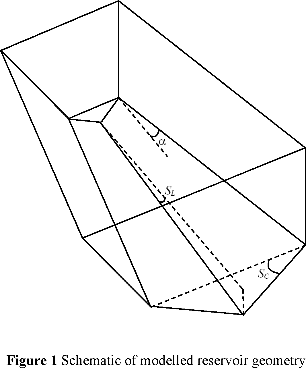
Sedimentation is a great concern for designers and managers of reservoirs, as it is responsible for reduction of reservoir’s operational life. This inevitable but unfortunate phenomenon reduces storage capacity of reservoirs and diminishes utility of infrastructure. Therefore, a hitherto unexplored and unreported area of sedimentation in reservoirs – spatial distribution of deposited sediment in a shallow reservoir – is investigated, employing numerical simulation model (TELEMAC-SISYPHE). Present study considers the Hirakud Dam on the River Mahanadi in eastern India as a test case. The study established generic trends between reservoir geometry variables and sediment distribution patterns in a reservoir through a heuristic set of numerical experiments for several configurations of reservoirs. The research work comprises of the following steps: Defining significant geometric parameters defining any typical water storage reservoir; Setting up and running numerical model for simulating flow and sediment movement for a range of possible geometries; Expressing characteristic parameters defining extent of sedimentation (height of sediment mound, spatial width, longitudinal extent) in terms of reservoir geometric parameters; Validating proposed generic relations with field observations of sedimentation of the Hirakud Reservoir within its two branches of Mahanadi and Ib. The study shows that the reservoir geometry and bathymetry significantly influence the flow velocity which, in turn, dictates the conditions of sediment transport and deposition within the reservoir. Lateral spread of sediment increases with an increase of expansion angle resulting in lower peaks of sediment dunes. Increase in cross slope increases the flow velocity, causing higher movement of sediments. Further, cross slope has direct influence in increasing transverse movement of sediment towards central dip resulting in a narrower sediment footprint across the reservoir section. Maximum height of evolution moves upstream, while minimum isoline moves downstream with an increase of longitudinal slope. The developed relations would be helpful to the reservoir managers in understanding the nature of bed elevation rise in respective reservoirs and for arranging proper desiltation of sediments for conserving reservoir capacity.