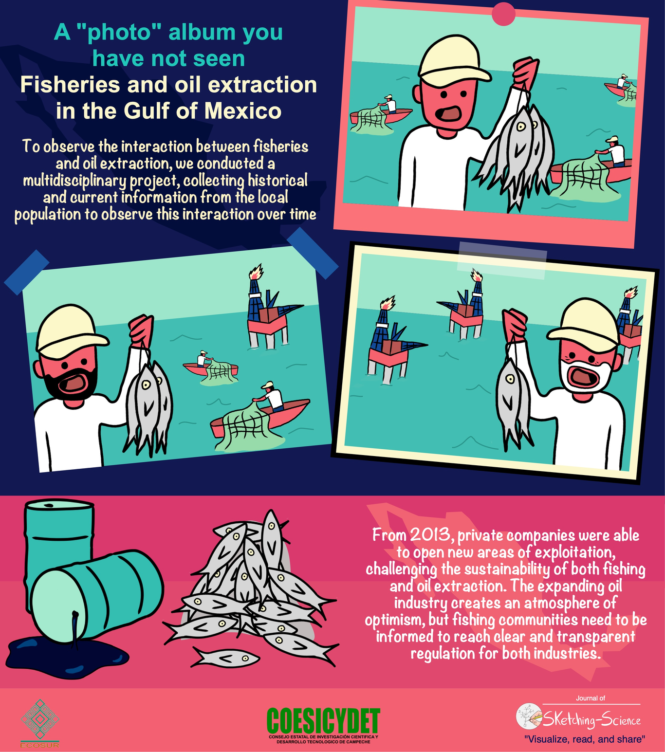
We all have an album with old photos, a collection of newer digital images and in the future surely we will have many others in more innovative formats. When comparing old photos with recent ones, we can observe how people, society and the environment change over time. Something similar happens with our experiences. We have old images of crucial moments in our history that we store in our album of memories, and we dream of how we want the future to be. From here on, let's imagine that taking a photo at a certain moment in time is similar to collecting information of society and environment for a baseline study. Years ago, we began to be distant spectators of the relationship between two critical economic activities: fisheries and oil extraction. These two activities take place in the Gulf of Mexico, which includes the coasts of the state of Tabasco. The interaction between both activities is certainly not a voluntary one, but somewhat circumstantial. This fortuitous relationship between fisheries and oil extraction was originated due to the natural wealth specifically concentrated in the Gulf of Mexico. Through the interaction between these two activities, certain concerns have arisen as to how we can maintain the sustainability of oil extraction and fisheries. To observe the evolution and interaction of such economic activities, we interviewed fishers to obtain valuable historical information stored in their memories and experiences. All fishers recognize that one of the main protagonists implicated in oil extraction has always been the Mexican government, under the name of Petróleos Mexicanos (PEMEX). However, law reforms in 2013 allowed private companies to open new areas of exploitation in the Gulf of Mexico \cite{espinoza-tenorio2019}. The recollected images or historical information gave us an insight as to how different actors modified fisheries and oil extraction. On the other hand, the most recent information collected were similar to "panoramic digital photos" showing all actors that coexist on the coasts of the Gulf of Mexico. Historical and current information were like old and new "photos" taken with the highest possible resolution to observe in detail how both activities modify the landscape. From this information or "photos" we obtained, we could extract relevant data to improve the sustainability of both coastal activities.