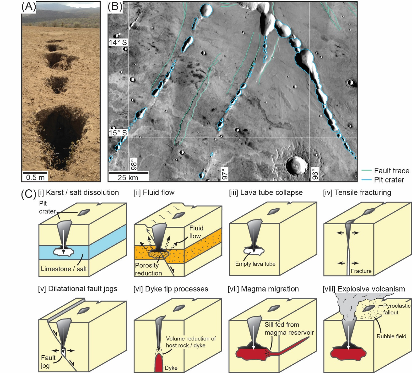
Pit craters are enigmatic, quasi-circular depressions observed on rocky (e.g., Earth and Mars) and icy (e.g., Enceladus) planetary bodies, and numerous asteroids. These depressions are not related to meteorite impacts. Instead pit craters are thought to be generated by overburden collapse into a subsurface cavity (e.g., created by dilatational faulting), or volumetrically depleted zone (e.g., an evacuated magma reservoir or conduit). The surface size and distribution of pit craters should thus provide an important record of otherwise inaccessible subsurface processes. Because we cannot access the subsurface structure of pit craters observed on planetary surfaces, we rely on physical and numerical models to infer the subsurface processes linked to their formation. Here, we use 3D seismic reflection data to quantify the palaeosurface and subsurface geometry of pit craters. These data enable us to identify whether pit craters connect to and their formation thus related to underlying structures. We map 59, Late Jurassic pit craters deeply buried within a sedimentary basin, offshore NW Australia. We demonstrate that some pit craters extend down and appear physically connected to igneous dykes, whereas others connect to dyke-induced and tectonic faults, seemingly where faults are steeply dipping and dilatational. There are no apparent relationships between pit crater geometries (e.g., palaeosurface expression or vertical extent) and the different magmatic and fault-related mechanisms we infer drove their formation. Reflection seismology is a powerful tool for understanding how pit craters form and whether their surface expression can be used to reconstruct subsurface structures and processes on other planetary bodies.